A plain-language overview of the proposed Peninsula County, the communities it would include, and the questions the Committee is evaluating.
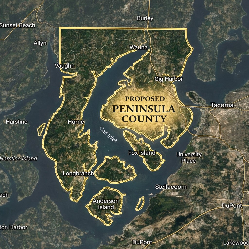
The proposed Peninsula County boundary is currently under study. The map shown here is a preliminary reference. No boundary has been formally adopted or submitted for any official purpose.
The proposed boundary is intended to reflect the geographic reality of the Peninsula region — the area west of the Tacoma Narrows Bridge, encompassing incorporated cities, unincorporated communities, and the surrounding islands.
Download Boundary Map (PDF)The proposed Peninsula County would include the following communities and areas, subject to final boundary determination. This list represents the full range of communities the Committee is committed to including in its feasibility research and outreach.
The Tacoma Narrows Airport (GRF), located within the proposed county boundary, presents a unique and complex jurisdictional question. As a public-use general aviation airport currently operating under Pierce County authority, any transfer of governance, ownership, or operating responsibility to a new county would require extensive legal, financial, and operational analysis. The Committee considers this a significant area of study within the broader feasibility review. No assumptions about airport governance have been made at this stage.
The proposed boundary and scope are under study. Nothing on this page constitutes a formal proposal, petition, or legal submission. The Committee is in the research and feasibility phase. Any formal action would require compliance with Washington's constitutional and statutory requirements.